
About
iPlan is a free online game that allows learners to construct, investigate, and solve simulated urban and regional planning problems. Suitable for use on smart phones, tablets, Chromebooks, and laptops, iPlan allows learners to explore the impacts of land-use decisions in their own local contexts. The system uses geospatial data, ecological and economic models, and optimization routines to transform any location in the contiguous United States into an interactive land-use planning simulation. Players construct rezoning plans that address socioeconomic and environmental issues, and their plans are evaluated by virtual stakeholders who advocate for different community priorities. iPlan thus provides a flexible platform for exploring complex land-use issues nationwide.
If you interested in using iPlan with students or as part of your education and outreach activities, let us know how we can help! Also, you may want to read our quick start guide, or check out sample lesson plans and other teaching resources.
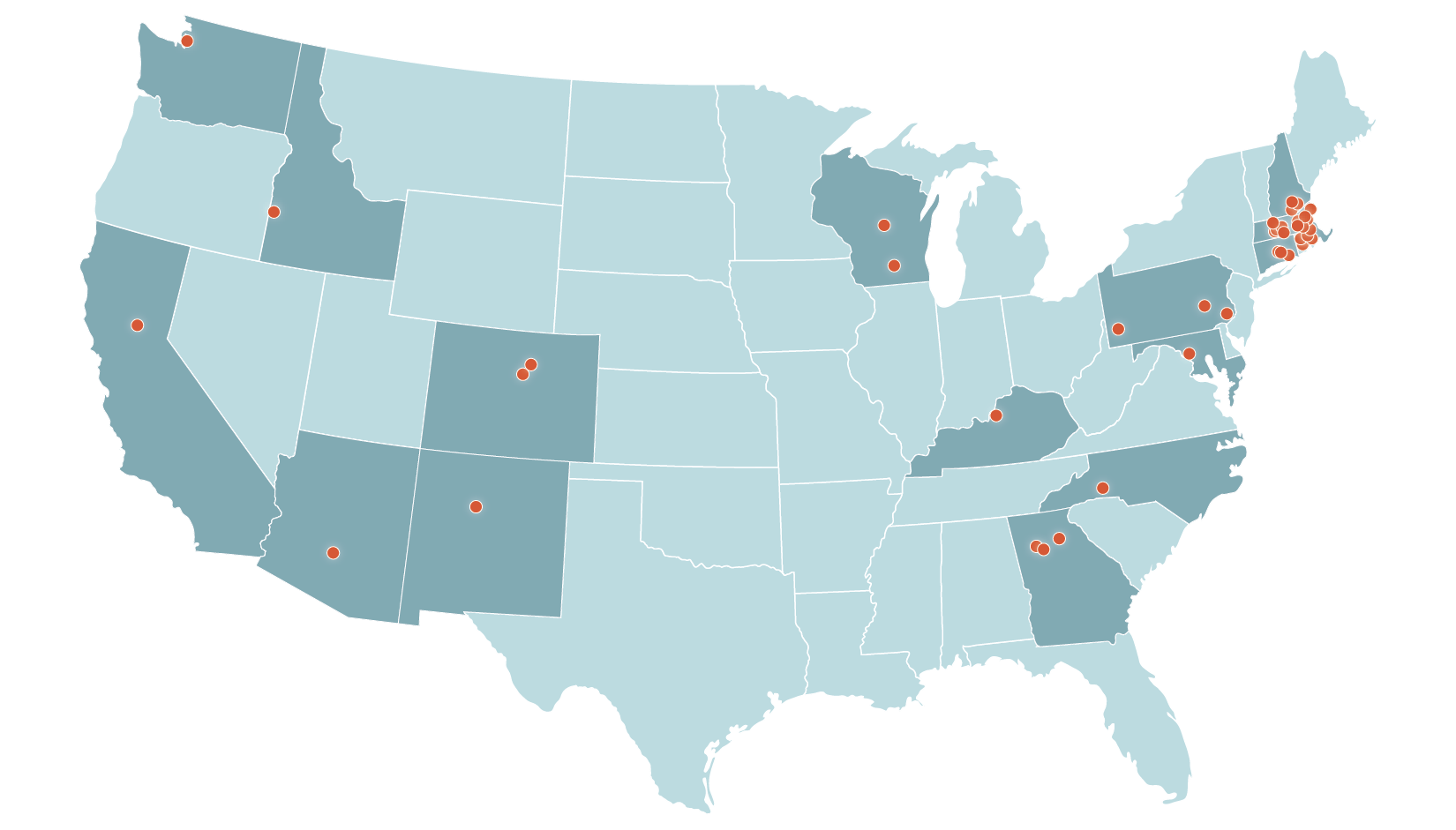
Where Educators Are Using iPlan
Testimonials
"The iplan tool is a very realistic modeling tool. It was easy to use for both me and my students, and allowed each student to engage with the model at their own level. I loved the fact that we could model our community—I have been struggling to find ways to teach about ecological restoration, and its implications at the local level, that shows kids real world applications, and this tool really helped me do that. My students really buy into learning more when the topic at hand relates to where they live, play, and go to school."
"As a high school science teacher there are some concepts that are easy to get across, and some nuanced points that are not so easy. iPlan allowed the students to interact with land science concepts in a way that gave them motivation and made it much more natural for them to discuss the issues and opportunities that we were putting to very real use in developing plans for [a redevelopment project in our town]. Their creative ideas and maps were well received when presented to the [local] Planning Board . . . , providing a direct link between their school learning and this very important project that has the potential to influence the nature (and finances) of [our town] for decades to come."
We Value Your Feedback!
Educators, please take a brief survey to tell us about your experience with iPlan.
Take the SurveyFlexibility
Educators have used iPlan in a range of pedagogical contexts, including in units on climate change, human geography, civics, ecological restoration, sustainable cities, and more. iPlan addresses state standards and other curriculum requirements related to complex problem solving, environmental literacy, analyzing and interpreting data, the roles of citizens, and use of simulations or models. Educators can use iPlan with learners for as little as 30 minutes or as long as several hours, and suitable models can be created for or by students in less than 5 minutes.
Authenticity
iPlan not only constructs maps for any location in the contiguous United States, enabling learners to explore complex land-use issues in their own local contexts, but it also models various stakeholder views, from business and home owners to environmental and community activists. Learners experience the challenges of designing solutions to land-use problems when people disagree about the priorities and desired outcomes.
Accessibility
iPlan works well for high school and middle school students and can run on any Chromebook, tablet, smartphone, or computer with internet access. All resources are incorporated into the simulation, and resource texts are short, enabling use with English language learners. Learners at different levels can work through the simulation at their own pace, and the simulation can be used by individuals or groups.
Fidelity
iPlan uses real land-use data, economic and ecological models, and authentic practices to simulate land-use planning processes in the real world. This enables learners to explore the effects of land-use change on ecological and socio-economic factors and to experience how urban and regional planners classify and manage land in response to the diverse goals and priorities of stakeholders. Educators can link the activities in iPlan to real-world civic processes, helping to connect classroom learning to civic knowledge and engagement.
If you use iPlan in your research or in any publications or presentations, please read our guidelines for acknowledgment.